STEADI: intervene
How Seniors Use Travel Weather Maps to Avoid Falls
Learn how to read travel weather maps before heading out to reduce the risk of falls from rain, snow, or icy pavement. This guide explains the three key map signals that help seniors decide if a trip is safe.
The useful question at the front door is not simply whether it will rain today. It is whether the sidewalk, curb cut, parking lot, church steps, pharmacy entrance, or driveway will be wet, icy, or changing while an older adult is actually out there. That is where travel weather maps become less about watching dramatic radar colors and more about preventing an ordinary trip from becoming a fall.
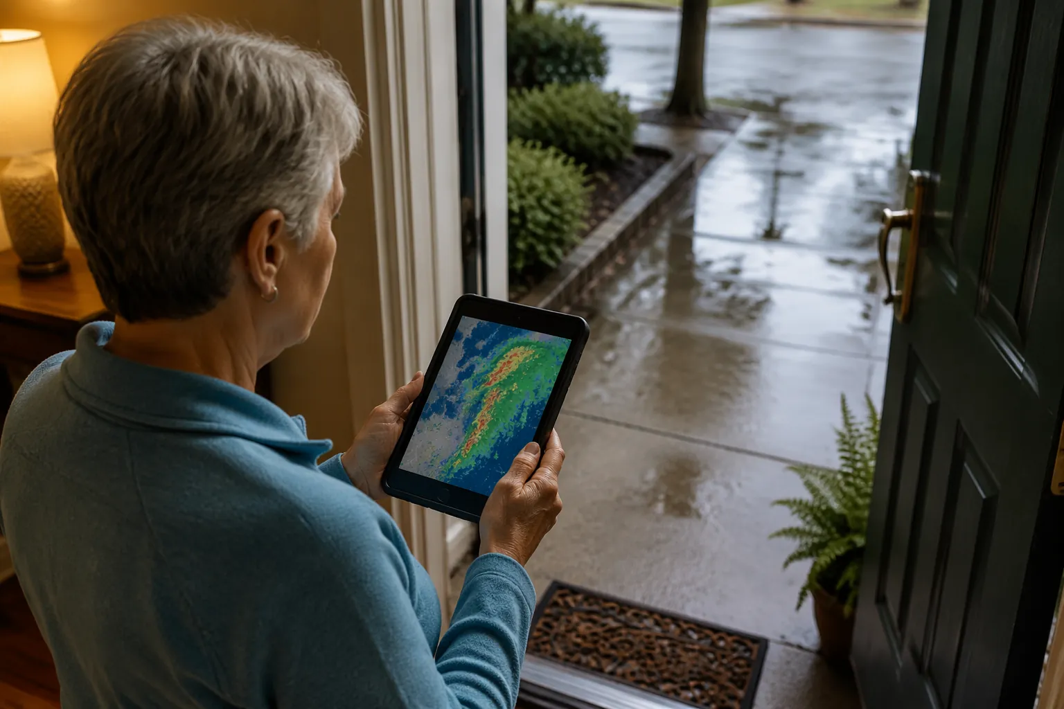
A daily forecast can say “showers later” and still leave a person guessing about the exact hour of a grocery run. A storm can pass before lunch and leave wet leaves on a shaded walk. A sunny afternoon can follow a freezing morning and still hide a slick curb. For fall prevention, the map matters when it answers a physical question: what surface will this person step on, at this time, along this route?
This is not only a winter problem. In a Johns Hopkins prospective cohort study of 240 older adults with glaucoma followed over 3 years, warmer temperatures were associated with higher odds of injurious falls, and summer had 2.69 times the risk of outdoor injurious falls compared with winter. The study was specific to older adults with glaucoma in the Mid-Atlantic, so it should not be stretched into a universal weather rule. But it does correct a common habit: treating fall-related weather checks as something needed only when snow is in the forecast.[1]
The broader stakes are not small either. NCOA cites CDC data that falls send about 3 million older adults to emergency departments each year.[2] A weather map will not remove that risk. It can, however, help an older adult or caregiver make a better go, delay, or cancel decision before wet pavement or black ice becomes a surprise.
The Three Signals To Check Before Leaving
A good pre-trip weather check does not require learning every layer in a forecasting app. For a short outdoor trip, three signals carry most of the practical value:
- Real-time precipitation radar: where rain, snow, sleet, or storms are right now.
- A time slider or future-cast map: what the route is expected to look like at the exact hour of travel.
- Pavement temperature or route-condition indicators: whether the surface itself may be slick, especially near freezing.
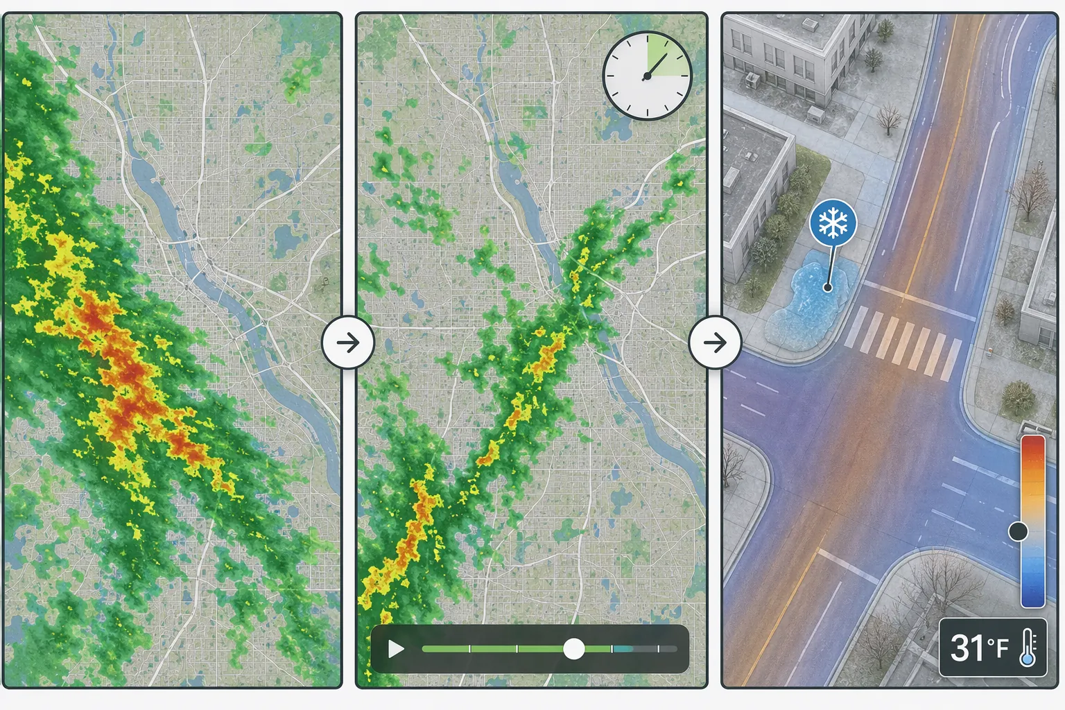
Check them in that order. Radar tells you what is happening now. The time slider tells you whether the chosen hour is improving or getting worse. Pavement conditions tell you whether the ground may still be dangerous after the sky looks harmless.
Signal 1: Use Radar To See What Is Actually Moving Through
Start with real-time precipitation radar, not the daily icon. The daily icon compresses a whole day into one symbol. Radar shows whether rain or snow is approaching the neighborhood, already passing over it, or moving away.
For fall prevention, the most important radar detail is the edge of the precipitation. If the green or blue area is just arriving, the surface risk is likely increasing. If it has just passed, the sky may clear before the walking surface dries. If another band is behind it, a quick errand can become a wet return trip.
Do not make the radar map do more than it can do. It can show rain or snow moving through an area. It cannot tell whether the pharmacy entrance has a puddle, whether leaves are packed against the curb, or whether a shaded ramp was salted. Those still need a porch, driveway, or parking-lot check when possible.
Signal 2: Move The Time Slider To The Real Travel Hour
The time slider is where many ordinary forecast checks fail. A forecast for “late morning showers” does not answer whether leaving at 9:40 a.m. is better than leaving at 10:20 a.m. A future-cast or route-weather time slider lets the user move the map forward and look at the expected conditions for the hour they will be walking to the car, crossing the lot, or driving home.
For a short local trip, use the slider around three moments: departure, arrival, and return. A medical appointment may be dry on the way there and wet when the person leaves the clinic. A church service may start before the storm line arrives and end as the parking lot is slick. The return trip deserves its own check, especially when the older adult will be tired or carrying bags.
| Slider Check | What To Look For | What It Changes |
|---|---|---|
| Departure time | Rain, snow, or storm bands over the home area | Whether to leave now or wait |
| Arrival time | Precipitation over the destination and parking area | Whether drop-off, curb choice, or a closer entrance matters |
| Return time | A new band arriving after the errand or appointment | Whether the trip should be delayed, shortened, or rescheduled |
The time slider also protects independence better than a blanket cancellation. If the map shows the line of rain clearing in 30 minutes and the errand is flexible, delaying may preserve the outing without accepting the slickest moment. That is a different decision from “the weather is bad today,” and usually a more useful one.
Signal 3: Check Pavement Temperature When Freezing Is Possible
Black ice is the reason a normal radar map can feel reassuring and still be incomplete. Radar may show no current precipitation. The sky may look clear. But if pavement is near or below freezing, moisture from earlier rain, melting snow, runoff, or refreeze can make a curb, driveway, or shaded sidewalk slick.
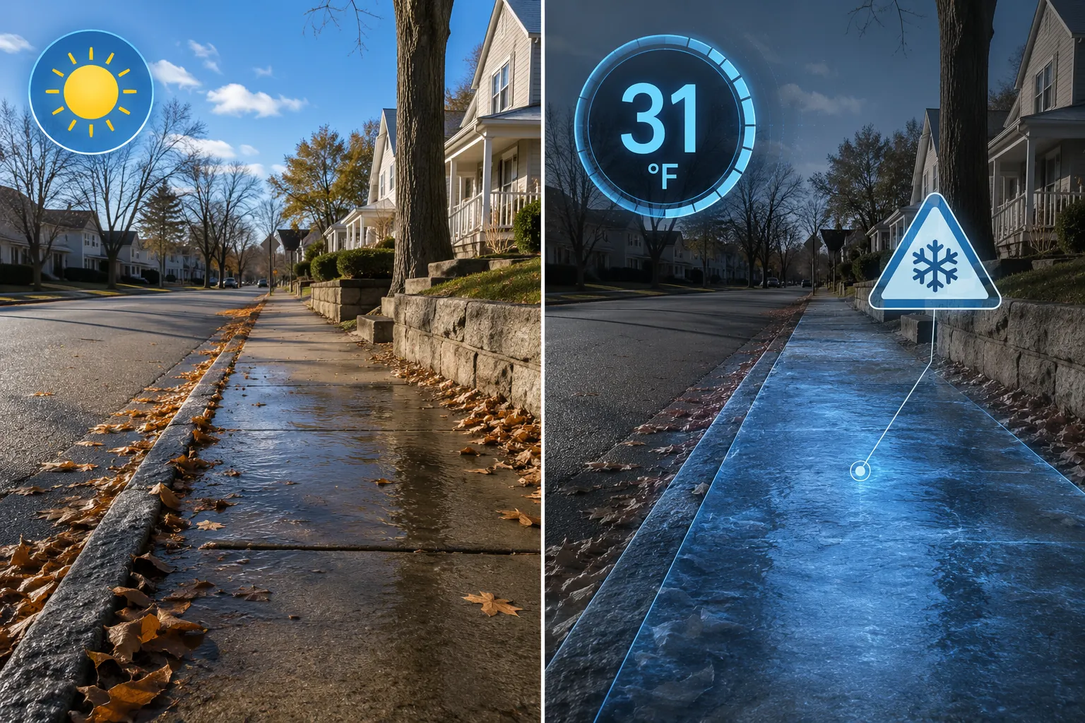
This matters most in the places older adults actually step: the first porch step, the driveway slope, the painted lines in a parking lot, the curb cut, the shaded side of the sidewalk, and the spot where a downspout drains across pavement. Air temperature helps, but pavement temperature is closer to the surface risk.
If a map or route tool offers an icy-pavement or road-condition layer, treat it as a warning to slow the decision down. It does not prove that every step will be icy. It does mean the “it stopped snowing” or “the radar is clear” argument is not enough.
Turn The Three Signals Into A Go, Delay, Or Cancel Decision
The point of checking a travel weather map is not to collect weather information. It is to make one decision before shoes are on and keys are in hand.
| Decision | Map Pattern | Practical Meaning |
|---|---|---|
| Go | Radar is clear or moving away; the time slider stays clear for departure, arrival, and return; pavement conditions are not near freezing | Use the usual fall-prevention habits, but the weather map does not show a strong reason to delay |
| Delay | Precipitation is moving through now but improves soon; the return time looks safer than the departure time; surface conditions are wet but not freezing | Wait for the safer window instead of canceling the whole outing |
| Cancel or change the plan | Storm bands remain over the route; the return trip worsens; pavement or route layers suggest possible ice near freezing | Use delivery, a ride to the entrance, rescheduling, or another route rather than forcing the trip |
For emergency warnings, severe weather alerts, or situations where the decision involves more than surface safety, use a fuller warning plan such as Emergency Preparedness for Elderly Travelers During Warnings. A fall-prevention map check is not an emergency instruction system, medical clearance, or driving clearance.
Where To Find These Map Signals Without Turning This Into An App Hobby
The app matters less than the signal. A good tool for this job should make radar, timing, and route conditions easier to see. If it buries those under beautiful animations, social features, or tiny controls, it may be less useful for an older adult standing at the door.
Drive Weather
Drive Weather is useful as an example of the time-slider idea because it shows route-based weather and lets users move through a full day of driving conditions. Its free version includes the route weather and interactive time slider; its icy-pavement indicator is part of the Pro tier, listed at $19.99 per year.[3]
For local senior trips, the lesson is simple: do not stop at “rain today.” Move the slider to the hour the person will be on the road or crossing the lot. If the map is worse at the return time than at the departure time, that is not a minor detail.
Weather on the Way
Weather on the Way is another route-oriented option. It offers departure-time optimization, CarPlay compatibility, and NOAA alerts along the route.[4] For an older driver or a caregiver helping from home, the practical use is to compare leaving now with leaving later, rather than treating the appointment window as fixed when it is not.
NWS Travel Forecast
The National Weather Service Travel Forecast is a free, ad-free, no-download browser tool that color-codes highway segments by forecast conditions in 6-hour blocks. The important caveat is access: the tool is described as experimental and limited to a South Dakota pilot, so it should not be presented as a nationwide solution.[5]
Large-Font Weather Apps
A senior-friendly interface still matters. Weather for Seniors, for example, emphasizes large fonts and a clear display, but it does not include radar.[6] That can make it easier to read the temperature or basic forecast, but it cannot carry the main storm-avoidance task by itself because it does not show where precipitation is moving.
Any app-based routine also depends on phone power and mobile data. If a loved one relies on weather maps while traveling, pair the habit with a backup communication plan such as Plan for Cell Phone Outages Before Your Senior Travels.
What To Check Around The House Before The Map Says “Go”
The map can narrow the decision, but the first walking surface is still local. Ready.gov winter guidance recommends checking local forecasts before heading out, keeping walkways clear, and ensuring adequate outdoor lighting.[7] NCOA’s winter fall-prevention guidance also emphasizes practical home and walkway steps during icy conditions.[2]
- Look at the porch, steps, driveway, and curb before committing to the trip.
- Give shaded pavement more suspicion than pavement in full sun.
- Treat wet leaves like a slick surface, even when the rain has stopped.
- Check whether the return trip will happen after dark, when puddles and ice are harder to see.
- Choose the entrance with the shortest, best-lit, driest walking path when there is a choice.
For longer seasonal trips, broader planning still matters. A weather-map routine fits inside a larger travel safety plan, not in place of one. A wider checklist such as Senior Travel Checklist When a State Department Warning Is Active is more appropriate when the trip involves unfamiliar places, official warnings, or complicated logistics.
A Simple Pre-Trip Routine
For most ordinary outings, the routine can stay short enough to repeat:
- Open a radar or route-weather map before leaving.
- Check whether rain, snow, sleet, or storms are over the home, route, or destination now.
- Move the time slider to departure, arrival, and return.
- If freezing is possible, check pavement temperature, icy-road, or route-condition indicators when available.
- Make one decision: go now, leave later, change the route or entrance, or cancel the outing.
A travel weather map cannot make a trip risk-free. It can show whether the surface risk is likely to rise, fall, or remain hidden during the exact window an older adult plans to be outside. That is a better decision than a daily forecast alone can offer.
References
- The Impact of Weather and Seasons on Falls and Physical Activity among Older Adults with Glaucoma: A Longitudinal Prospective Cohort Study. PMC.
- Winterize to Prevent Falls. National Council on Aging.
- Drive Weather. Drive Weather.
- Weather on the Way. Weather on the Way.
- NWS Travel Forecast. National Weather Service.
- Weather for Seniors. App Store.
- Winter Ready. Ready.gov.
Related reading
Noticed something outdated or inaccurate on this page? Flag a correction. We review every report against CDC, NIA, and AARP HomeFit guidance before updating a page.
Part of the Fall Prevention section.