STEADI: Intervene
How El Niño Changes Senior Winter Safety Tips by Region
With a very strong El Niño favored for the 2026-27 winter, the U.S. splits into opposite hazard zones, so a one-size senior winter-safety list no longer fits. Caregivers and older adults can use this region-by-region guide to see which cold, ice, and storm hazards their area actually faces and match prep to the local outlook on a shared NIA and CDC cold- and fall-safety baseline.
Know your zone before you buy another winter gadget
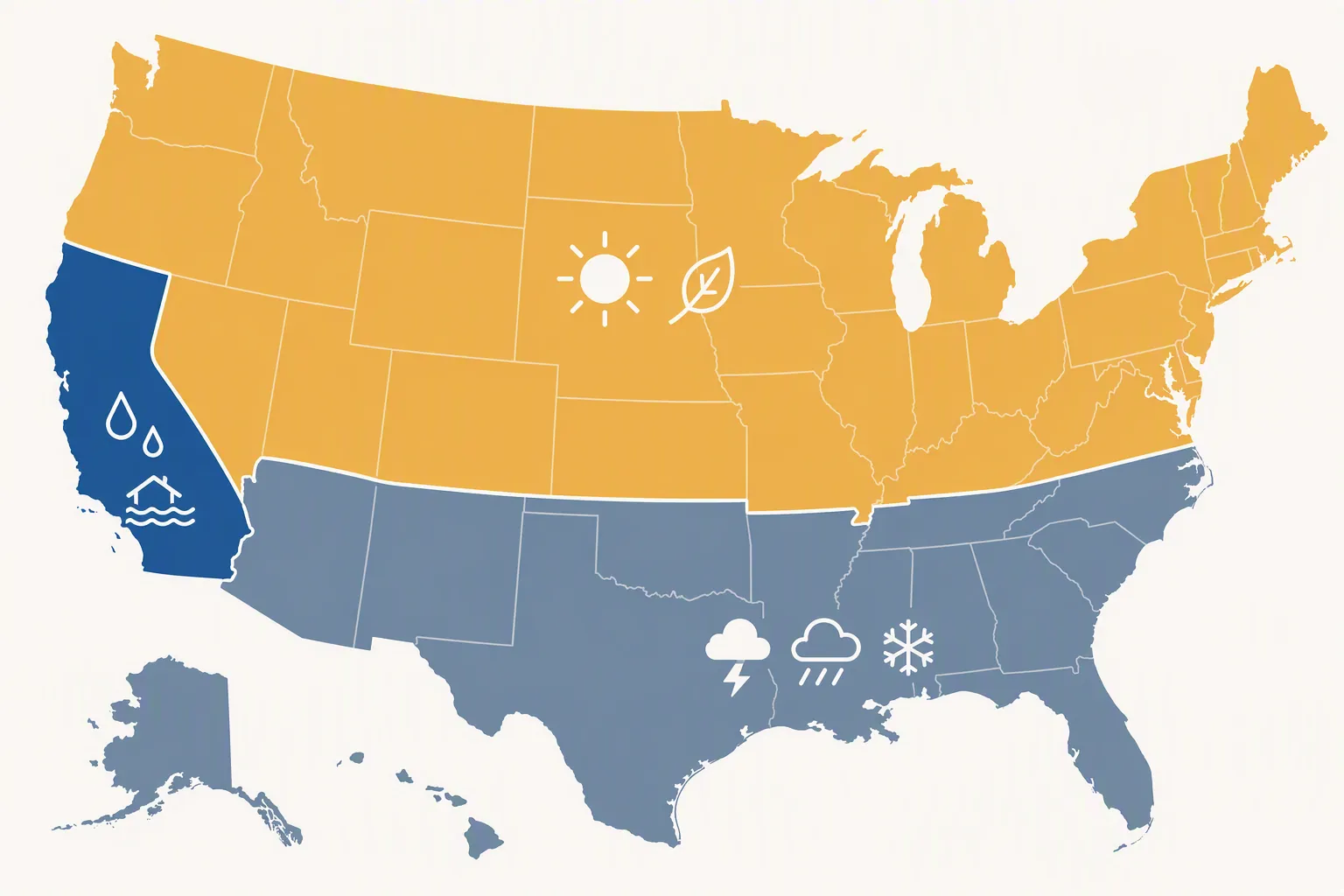
A useful regional El Niño winter-safety plan starts with a split map, not a shopping list. NOAA declared El Niño in June 2026 and, at that time, forecast a 63% chance that sea-surface temperatures would exceed the +2.0°C threshold used for a “very strong” event; CPC’s August 20, 2026 discussion then placed the odds of a very strong event above 90% and gave a 69% chance of exceeding every El Niño since 1950 by the Relative Oceanic Niño Index +2.5°C measure [1][2]. Those are planning signals, not promises. CPC cited 1997–98 and 2024 as close analogs, but an analog is not a schedule for your driveway, your parent’s porch, or your local power line [2].
The broad pattern is still useful: El Niño tends to push the storm track across the southern tier, favoring cooler, wetter, stormier conditions there, while the northern U.S. is more often warmer and drier [3]. That means the same winter can raise rain, flood, ice, and outage concerns in one home while lowering snowpack or lake-effect expectations in another. The shared baseline stays the same everywhere: keep the home warm enough, prevent wet and icy falls, and make the outage plan boring before anyone has to use it.
| Planning zone | Favored El Niño pattern | Senior safety emphasis |
|---|---|---|
| Coastal California and wetter Southwest pockets | Higher odds of above-normal precipitation in coastal California and adjacent southern Arizona | Wet-entry fall control, flood-aware routines, rain-chill hypothermia checks, outage-safe heat |
| Southern tier and Southeast | Cooler, wetter, stormier winter signal, with the Southeast among the highest-confidence wet areas | Storm-day medication and mobility plan, generator and carbon monoxide safety, freezing-rain and refreeze precautions when local forecasts call for them |
| Pacific Northwest, northern Rockies, northern Plains | Warmer and drier tilt | Do not overbuild for storms that are not favored; keep indoor cold, traction, and backup-contact basics |
| Great Lakes and Northeast | Lower odds of some snow signals, including reduced lake-effect or less snow in strong El Niño winters | Treat “less snow” as fewer events, not no ice; maintain path clearing, footwear, lighting, and outage readiness |
The baseline every region keeps
Before the regional work starts, set the cold-safety floor. NIA warns that older adults can develop hypothermia even when a home is in the 60–65°F range and advises setting heat to at least 68°F [4]. The American Geriatrics Society’s winter tip sheet uses 65°F as a lower minimum, which is a useful reminder that indoor temperature advice is not perfectly uniform across organizations; for planning, the safer move is to set the main living area to the NIA 68°F target and then check the rooms where the older adult actually sits, sleeps, dresses, and waits for help [4][7].
Wet cold deserves special attention in an El Niño winter because it does not look as dramatic as deep cold. CDC says hypothermia can occur at temperatures above 40°F when a person is chilled by rain, sweat, or submersion, and that a body temperature below 95°F is a medical emergency [5]. For a caregiver, that changes the inspection route: do not only ask whether the furnace works. Look for the damp coat left by the door, the wet socks, the unheated bathroom, the chair near a drafty window, and the person who may sit still for hours after coming in from rain.
- Put working thermometers in the rooms used most, not only near the thermostat.
- Keep a dry-shoe or dry-slipper station at the entry so wet soles do not travel across smooth flooring.
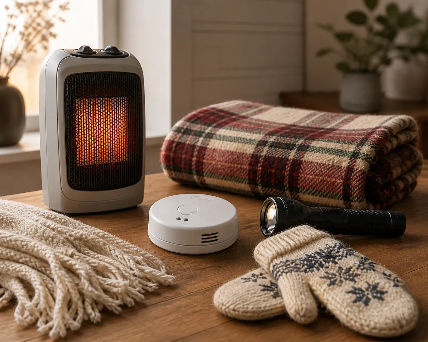
- Move space heaters at least 3 feet from bedding, curtains, blankets, papers, and furniture; never use a stove for heat.
- Use a battery-operated carbon monoxide detector, especially if any backup heat or generator plan exists.
- Place generators at least 20 feet from windows, doors, and vents, and keep them outside.
- Close off unused rooms and cover windows during a prolonged outage to hold heat where the person is actually living.
Those heating and generator rules come from CDC winter-storm safety guidance, and they matter most on the night when someone is cold, tired, and tempted to improvise [6]. Fall prevention also belongs in the baseline. In a national analysis of older-adult fall-related emergency department visits, 26.2% occurred in winter; among winter outdoor falls, 34.4% were weather-related, and about 97% of weather-related fall injuries involved slips or trips on ice or snow [8]. That study does not tell you which region will be worst this winter. It does tell you that when winter weather reaches the walking surface, the injury mechanism is usually ordinary: a foot slips, a hand reaches late, and help may not be nearby.
Coastal California and the wetter Southwest: make the entryway part of the storm plan
Coastal California is one of the places where El Niño most clearly changes the senior-safety list. CPC favors above-normal precipitation at greater than 50% probability for coastal California in key winter outlook periods, with a related wet signal extending into adjacent southern Arizona [2]. The practical hazard is not simply “rain.” It is rain arriving at the exact places older adults have to cross: the step down from the porch, the slick tile inside the door, the garage threshold, the curb cut, the parking-lot stripe, the ramp that was safe when dry.
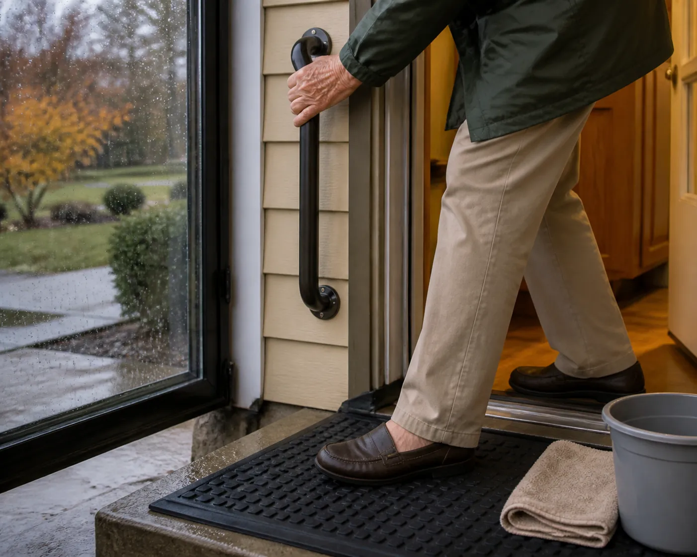
Start outside and walk in. If water pools at the first step, fix drainage or change the route before the first major storm. If the only handhold is the doorknob, add a better handhold. If the mat slides when pushed with one foot, it is not a fall-prevention tool. A wet-zone plan should include a non-slip exterior mat, a dry interior landing area, bright lighting, reachable towels, and a place to remove wet shoes without balancing on one leg.
For homes in hills, near burn-scarred areas, or near known flood-prone streets, the rain plan also needs a movement plan. Who checks the driveway before the older adult tries to leave? Which neighbor can confirm whether the street is passable? Where are medications and device chargers if the safest choice is to go before water rises? The point is not to make every rainy day an evacuation day. It is to avoid asking a person with a cane, walker, oxygen equipment, or low vision to make a threshold decision while the threshold is already wet.
This is the zone where the site’s wet-weather pieces are directly useful: use the rainy-weather fall-prevention guide for the reschedule, modify, or go decision, then pair it with the rainy-day home modification checklist and the rainy-day fall-prevention home guide for handrails, traction surfaces, lighting, and dry-shoe stations.
Southern tier and Southeast: plan for wet cold, storm delays, and local ice calls
Across the southern tier, El Niño raises the odds that winter safety will be a rain-and-storm problem as much as a cold problem. NOAA and USDA describe the El Niño winter pattern as wetter and cooler across the southern U.S., and NWS Tallahassee notes that the southern tier from California to Florida averages above-normal winter precipitation during El Niño, with some locations around 5 inches above normal [3][9]. CPC’s winter outlook also places the highest-confidence wet signal in the Southeast, exceeding 60% in the November–December–January period [2].
In this zone, the dangerous house may not look like a northern winter postcard. It may be a one-story home after two cold rains, with slick vinyl at the back door, a short outage, and a caregiver assuming ice is impossible because the address is in the South. If the local forecast uses freezing rain, sleet, winter mix, black ice, or refreeze, treat the outside route as closed until someone steady has checked it in daylight. A porch step does not need a snowbank to become a fall hazard.
- Before the first storm, decide who clears wet leaves, mud, ice, or storm debris from the primary entry.
- Set a rule that the older adult does not carry trash, groceries, pets, or laundry across a wet or icy threshold.
- Put flashlights where they can be reached from the bed, favorite chair, kitchen, and bathroom.
- Keep medications, glasses, hearing-aid supplies, mobility devices, and phone chargers in places that still make sense during an outage.
- Write down the backup heat plan, including what is not allowed: no stove heat, no indoor generator, no heater near bedding.
Florida and parts of the Southeast also need the storm-warning side of the plan. NWS Tallahassee flags the region’s stronger winter severe-weather concern during strong El Niño years, including higher winter tornado activity in central and south Florida in its historical review [9]. That does not mean every storm becomes a tornado threat. It means older adults who cannot move quickly should already know the safest interior room, how they will hear warnings overnight, and who calls if the power or cell service is unstable.
For this corridor, route the planning to the jobs that take time. Use the hour-by-hour power restoration plan if an older adult would be waiting at home after an outage, and the elderly storm-preparedness checklist for the stay-or-go decision and shelter-in-place kit. If the address is also in a tropical-storm or hurricane-prone area, the hurricane guide for seniors and the guide to understanding official hurricane hazard graphics are still useful because medication, backup power, evacuation timing, and helper assignments do not stop mattering after hurricane season.
Pacific Northwest, northern Rockies, and northern Plains: drier is not the same as prepared
In the Pacific Northwest and much of the northern tier, the El Niño tilt is generally warmer and drier rather than colder and stormier [3]. That changes the emphasis. It is a reason not to waste a caregiver weekend building a plan around the wrong main hazard. It is not a reason to skip the furnace check, the thermostat check, the handrail repair, or the neighbor call list.
The main mistake in a warmer-drier zone is letting the seasonal headline lower the household standard. A dry winter can still include cold nights, localized ice, wind outages, and a single storm that arrives when the driveway is untreated. For an older adult, the question is not whether the seasonal average looks mild. It is whether the safest route to the mailbox, trash bin, garage, pharmacy, and car still works on the worst day that actually arrives.
- Keep the shared indoor-temperature plan and check rooms where the older adult spends long periods.
- Do a smaller but real traction audit: entry mats, stair edges, railings, exterior lighting, and footwear.
- Avoid over-relying on “less snow expected” if the older adult lives on a shaded street, hill, rural road, or property with poor drainage.
- Confirm who will check in after an outage or cold snap, especially if the person uses powered medical equipment.
If backup power affects oxygen, refrigeration for medication, lift chairs, adjustable beds, communication devices, or mobility equipment, borrow the practical parts of the site’s emergency-helper framework: a named helper, a medication cushion, and a written device-power plan. The safety checklist for seniors living alone during wildfire conditions is written for a different hazard, but the named-helper and backup-power logic carries over cleanly.
Great Lakes and Northeast: less favored snow still leaves ice underfoot
The Great Lakes and Northeast need a tighter message: the El Niño signal may reduce some snow expectations, but it does not remove winter. CPC and NOAA seasonal materials lean toward below-normal precipitation in parts of the northern U.S., and strong El Niño winters have averaged less snow in the Northeast in Cornell’s regional review [2][10]. For lake-effect areas, a weaker seasonal signal does not make every local snow band disappear.
For older adults in these regions, the plan should stay focused on the transition surfaces. The most dangerous area may be the shoveled strip that refreezes after sunset, the lobby tile after boots track in slush, the curb cut beside a plowed snow ridge, or the ramp that looks clear from the kitchen window. When the forecast gives mixed precipitation or rapid temperature swings, assume yesterday’s meltwater may be tonight’s ice.
- Arrange snow and ice clearing before it is needed, and specify the full path: door, steps, railing side, sidewalk, trash area, mailbox, and car.
- Keep salt, sand, or other traction material where the person applying it can reach it without crossing the untreated surface first.
- Check building entrances, not just private homes; apartment lobbies and senior-housing entry tiles can become wet-surface hazards.
- Build the outing rule around surfaces, not pride: delay non-urgent trips when the route is icy, dark, or not yet cleared.
Use the forecast to choose the right work
A very strong El Niño outlook is enough to change planning priorities, but not enough to replace local watches, warnings, and common sense. Seasonal outlooks describe favored outcomes over large areas. The last decision before a storm still comes from the local forecast, the condition of the home, and the older adult’s mobility, vision, medications, cognition, and backup support.
This article is general safety information, not medical advice. If cold exposure, falls, dementia, heart or lung disease, diabetes, medication timing, oxygen, dialysis, refrigerated medication, or powered medical equipment is part of the situation, involve the clinician, utility medical-baseline program, local emergency office, or home-health team before the first storm.
The right winter plan this year is not a longer generic checklist. It is the shared cold-and-fall baseline, then the regional add-on that matches the actual hazard: wet entries and flooding in coastal California, storm delays and local ice calls across the southern tier, restrained but real cold-safety work in the warmer-drier North, and surface-by-surface traction planning where snow may be less favored but ice still has a way to find the step.
References
- El Nino forms, expected to strengthen, say NOAA forecasters, NOAA
- Prognostic Discussion for Long-Lead Seasonal Outlooks, Climate Prediction Center, August 20, 2026
- El Niño in the Northwest: What can we expect?, USDA Climate Hubs
- Cold Weather Safety for Older Adults, National Institute on Aging
- Prevent Hypothermia & Frostbite, Centers for Disease Control and Prevention
- Stay Safe During & After a Winter Storm, Centers for Disease Control and Prevention
- Tip Sheet: Winter Safety for Older Adults, Health in Aging Foundation
- Nonfatal Weather-Related Falls Among Older Adults Treated in US Hospital Emergency Departments, 2015, Journal of Safety Research, 2021
- El Niño-Southern Oscillation (ENSO), National Weather Service Tallahassee
- El Niño Impacts in the Northeast, Cornell Northeast Regional Climate Center
Related reading
Noticed something outdated or inaccurate on this page? Flag a correction. We review every report against CDC, NIA, and AARP HomeFit guidance before updating a page.
Part of the Fall Prevention section.